
Satellite-Based Flood Risk Analysis of Pune District Using GIS and Remote Sensing
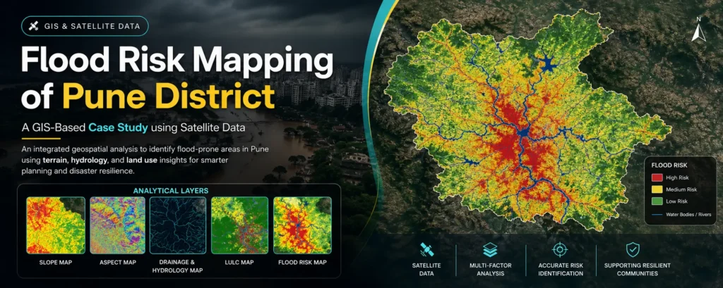
Satellite-Based Flood Risk Analysis of Pune District Using GIS and Remote Sensing Introduction : – Flooding has become a recurring challenge in rapidly urbanizing regions like Pune district in Maharashtra. With increasing rainfall variability and uncontrolled urban expansion, identifying flood-prone zones is critical for sustainable planning and disaster mitigation. This project presents a satellite-based flood […]
Satellite-Based Flood Risk Analysis of Pune District Using GIS and Remote Sensing Read More »